The world – a bustling place
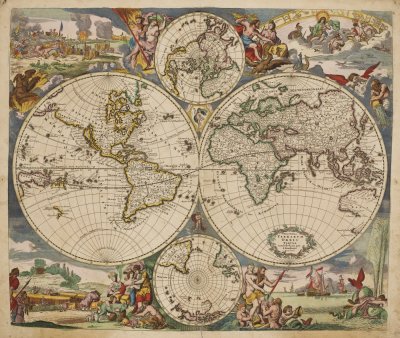
The world map (shelfmark: MUE Kart III 7 : 2) displaying the two hemispheres and the two poles is framed by allegorical representations of the four elements (water, air, earth and fire), expressing human and natural forces. Australia (bottom right) was still referred to as New Holland at that time.
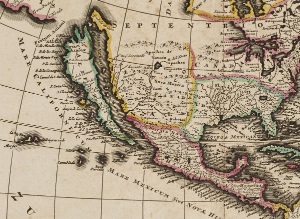
California, on the map of America (shelfmark: MUE Kart III 7 : 3), is displayed as an island. In 1622, California separated itself from the American mainland – neither geologically nor politically – but on grounds of a cartographic slip: the title page of a Spanish book showed California as an island, an error, which was to be copied on almost 250 maps for the next 200 years.
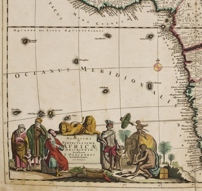
The cartouche of the map of Africa (shelfmark: MUE Kart III 7 : 4) is supposed to illustrate the ethnic variety of this continent. On the map there are many place names in the coastal areas due to the knowledge of navigators; the inner land mass was probably charted according to travelogues. Sparse designations and boundaries over large areas hide the fact that the interior of the continent was mostly terra incognita in those days. This is illustrated by the depiction of the fictitious twin lakes of Zaire und Zaflan, as well as an imaginary tributary to the Nile flowing from the Sahara desert.
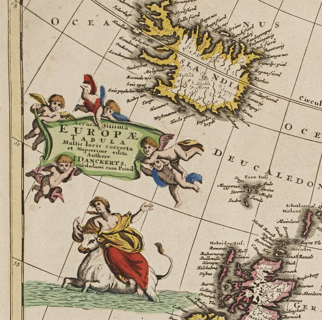
The goddess Europa rides on her bull on a comparatively austere map of the old continent (shelfmark: MUE Kart III 7 : 6). Detailed place names cover the central areas whereas cartographic symbols stand for mountains and forests in the rather unknown peripheral regions.