Subsequent maps in the 17th century
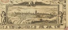
Joseph Plepp reduced the Schöpfkarte to a more manageable size, yet without much change. However, he did add a beautiful cityscape. The very accurate, finely engraved view of the city illustrates Bern viewed from the south. This is rather uncommon for a south oriented map. The curves of the river Aare are detailed closely. It is striking that despite reducing the map to less than 10% of its original size, Plepp kept 90% of the names. Few of the designations were altered slightly. View on E-rara.
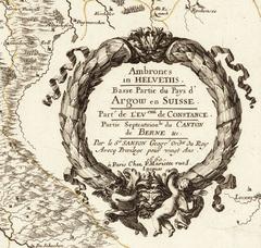
Ambrones in Helvetiis by Nicolas Sansons illustrates the parishes of the dioceses. Ambrones refers to a district presumed to have existed in the era of the Helvetians. It was supposed to have been in a region of the canton of Solothurn and the German-speaking part of the canton of Bern. However, the geographical foundation originates from Schöpf. In this example, the designations for bodies of water are missing. View on E-rara.
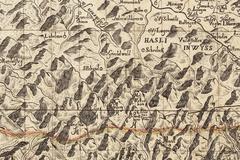
Albrecht Zollinger’s map (first published ca. 1694) shows a larger area than the Schöpfkarte. Maps other than Schöpf’s were also used as templates. The Wetterhorn, Jungfrau and Eiger are hidden behind unnamed mountains. View on E-rara
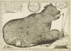
The well-known map of the Bernese state territory in the shape of a recumbent bear emerged around 1690 from a baroque gimmick and was issued repeatedly thereafter. With this map, the illustration of territorial autonomy and power of Bern, symbolised through the bear, was far more important than topographical accuracy.