Subsequent maps in the 18th century
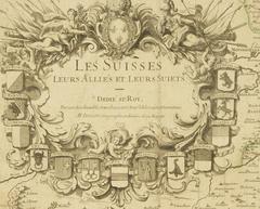
During the period between 1701 and 1703 the French cartographer and publisher Alexis Hubert Jaillot published a reprocessed map of the confederation in four sheets. This map is in part directly inspired by the Schöpf-Mercator-lineage. Above the coat of arms of the federal places the title cartouche shows the French shield adorned with lilies and the royal crown. View on E-rara.
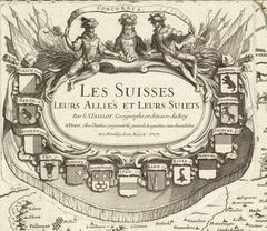
In 1703 at the federal hearing in Baden, the realm of Bern demanded the taking of a stand against this disgrace to the honor of the nation. However, the hearing resolved to ignore the matter, to keep an eye on a possible sale of the map, and to confiscate it if necessary. Later editions, including the displayed version from 1783, no longer contain the shield of lilies, but rather depict the Three Confederates with the banner “Concordia”. View on E-rara.
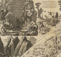
The Scheuchzerkarte is largely based on the Swiss maps by Johann Conrad Gyger (1657) and Hubert Alexis Jaillot (1701/03). It is the last large-scale general map of Switzerland in the 18th century. However, it does not mark a cartographical new beginning. With its peculiar, stylized depiction of the mountains, it demonstrates a curious regression in comparison to the Gygerkarte. The decorative embellishments captivates through its splendour. View on E-rara
The Willommet map is an unsigned original drawing, which stayed undiscovered for a long time. Surprisingly, the map is south-oriented, despite the general establishment of north-oriented maps in the 17th century. A new feature in comparison to the Schöpfkarte is depiction of the road network in this map. The focus is restricted to the main roads (Grands Chemins).
Overall, the map is in bad condition. It is likely that it was exposed to damaging light for a prolonged period. For this reason, the map was carefully unrolled and digitized in 2019. View on E-rara (stitching: Sabrina Bühlmann)
Like the map by Tschudi or the Schöpfkarte, the Atlas Suisse represents a milestone in Swiss cartography. Between 1796 and 1802, a completely new and consistent map emerged from a private initiative. The Atlas Suisse, also known as Meyer-Weiss-Atlas, is the oldest work of cartography, which incorporates all of Switzerland and bases on comprehensive and scientific land surveying. Until the publication of the Dufour map in the middle of the 19th century, the Atlas Suisse was the most exact exhaustive map of Switzerland.